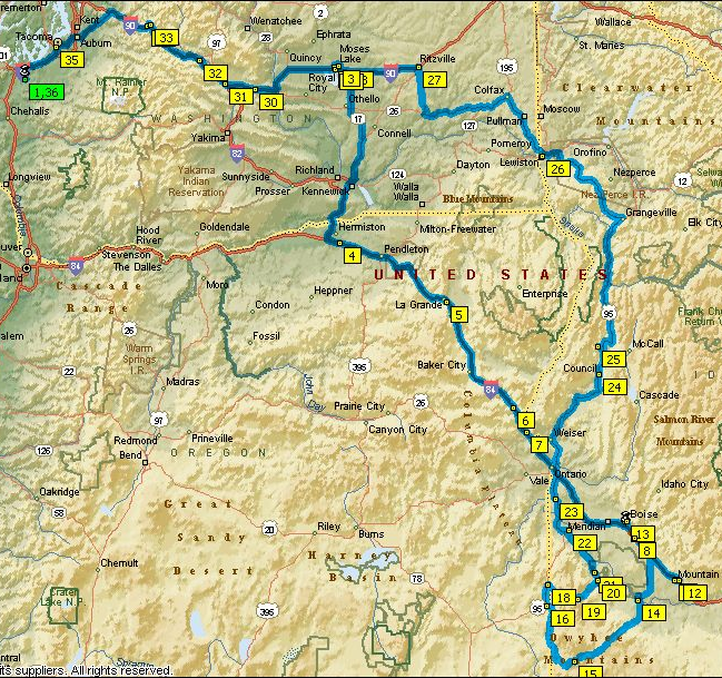
After our two nights at Boni Spring we decided we would visit Silver City before heading north to find our last campsite of the trip. After a hearty breakfast of corned beef hash and eggs we broke camp. While David and I finished packing everything into the trailer and truck Mom took Farron for a walk down the road. I guess it took us a while to finish loading as we found Mom and Farron nearly a mile down the road, Farron was running ahead trying to extend his hike as far as he could. We continued west into the Jordan Valley.
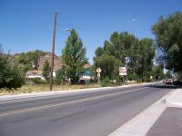
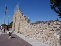
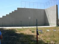
Since we didn’t know how far it would be to Silver City and out again we decided to fuel up in Jordan Valley, Oregon. We also stopped to take a picture of the Pelota wall and the Old Basque Inn.
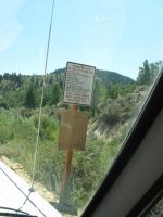
While in Jordan Valley we also asked for directions to Silver City. We headed north out of town on Hwy 95 looking for Cow Creek Road. After about 15 minutes we turned east onto Cow Creek road. It is a good two lane gravel road with turnouts. It was Sunday just before noon so many of the weekend campers and hunters were heading out. Once we turned onto the Dewey-DeLamar road we were on a primitive one lane road that resembled the historic ghost town we were heading for. It follows a stream was narrow in spots and made of dirt and native rock. All along the stream we saw people panning and prospecting. We passed old home sites as well as one currently occupied residence. We hardly knew when we passed the old towns of Dewey or DeLamar. We arrived in Silver City about lunch time. We took a little walk down town and decided to have lunch at the Idaho Hotel.
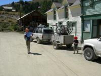
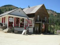
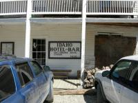
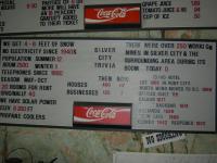
After lunch we took a quick drive around town. It was getting late and we still had some driving to do before we found a campground for the night. We left town back toward Ruby then east on the Silver City road toward Murphy. Once we got down to Hwy 78 just outside Murphy we found we had cell phone reception again and made some quick calls that we had survived then headed west to Hwy 95 North. On the way we drove through Marsing were mom’s Grandparents had lived and saw Lizard Butte. We followed Hwy 95 through Homedale, Fruitland, Payette, Weiser and countless other small towns.
In Weiser we had to decide on camping back at Farwell Bend or continuing north. We had decided to stay of the interstate on the way home so we didn’t really want to head for Farwell Bend. Looking on the map we saw a campground at Evergreen but could not find any phone number or GPS location for it. We decided to keep north on Hwy 95 and try our luck. It was getting late, about an hour before sunset, when we stopped in Council to fuel up again. We asked the clerk inside about Evergreen campground. She didn’t know anything about Evergreen but said there was a Lost Lake about 15 minutes further down the road. We stopped at the ranger station on the way out of town and looked at the recreation map. There was an Evergreen Campground as well as Cold Springs and Lost Valley. It was 30 minutes before sunset now as we pulled into Evergreen Campground. Had we been traveling in a Motor home or pulling a large camping trailer this would have been the ideal site with its nicely paved parking pads and hookups. It was not going to work for our large tent.
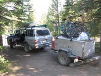
We decided we would head up to Lost Valley. At the restaurant in Pine Ridge we turned left onto Lost Valley Road, another gravel forest road. The first campground we came to was Cold Springs. It looked a little torn up as they had recently finished a large danger tree removal operation. The grounds were still covered in limbs and debris. We made a quick drive around and settled on a nice large site close to the rest room. Again Mom and Farron went to register our site as David and I set up the tent and got out the stove for our last camping trip meal. Mom made some great ½ pound burgers and we ate by lantern light listening to all the forest sounds. This was much different the camping we had done at Boni Spring with the wide open space. Cold Springs is tucked away in the forest with only a few feet to spare around our tent and pick neck table. We even saw a resident pair of deer, a doe and young buck. Luckily they were the only cows crashing around we heard that night. Regardless, we locked up all the food and garbage in the back of the Land Cruiser. We had a good sleep and, as far as we know, didn’t get any visits by Yogi.
We decided since we had run out of water in the trailer for dishes, an easy breakfast would be best. After breakfast we broke camp for the last time, packed up and were on the road again. Heading north on Hwy 95 we followed the Little Salmon River until Riggins where we picked up the Salmon River. Riggins is home to several white water rafting companies. We followed the Salmon until just before White Bird. Here we left the river and had a steep climb out of the Salmon River valley then down into the Palouse and Grangeville. From the top of the grade we could see the location of the 1877 Battle of White Bird Canyon which was the first fight of the Nez Perce war. Grangeville is near an excavation of a Mammoth skeleton in the early 1990s. With further excavation they found a mammoth grave yard containing hundreds of skeletons. This was also the beginning of the wheat fields we wouldn’t see the end of until Ritzville. We traveled across the Nez Perce Indian Reservation to the Clearwater River near Lewiston. In Lewiston we had our second to last fuel stop then took the nearly 7 mile long Lewiston Grade out of town back up to the rolling wheat fields of the Palouse.
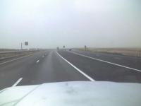
Just past the Grade we left Hwy 95 for Hwy 195 north to Pullman and Spokane. In Colfax we changed Highways again for Hwy 26 West toward Othello. At Washtucna we turned north on Hwy 261 toward Ritzville and a milkshake. As a child I remember stopping often in Ritzville on our way home from Spokane to get a good old fashioned shake. It was pretty windy by now and the fields in the area had been recently plowed. This made for a slow dusty drive. Unfortunately when we arrived we found the stand to no longer be there. With a milkshake still on my mind we stopped at Zip’s Drive Inn. Now for our only interstate portion of the return trip, 45 miles headlong into the dust storm.
We stayed the night in Moses Lake. After Dad fixed us breakfast David, Farron and I continued on the final leg of our trip. We took a slight detour (following the bicycle detour) at Snoqualmie Pass. We followed the old road down between the east and west lanes to Denny Creek Campground. All my life I have traveled I-90 and never new there was a wonderful campground and recreation area between the freeways. Once in Olympia David moved his belongings to his Volvo and headed out for Seattle.
Trip total, 1,625 miles. 7 days 6 nights. 9 full gas fill-ups.
